Echarati, Quillabamba
Echarati, Quillabamba
Echarati, Quillabamba, Santuario Nacional Megantoni
Echarati, Quillabamba, Santuario Nacional Megantoni

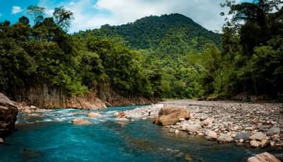
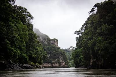
Pongo de Mainique is one of Peru’s most impressive and sacred places: a 3 km natural canyon where the Urubamba River narrows to just 45 meters between 1,200-meter-high rock walls. Located inside the Megantoni National Sanctuary in Cusco, it is sacred territory for the Matsiguenka people and home to extraordinary biodiversity.
Pongo de Mainique also known as Pongo de Maenique, Pongo de Mainiqui or simply “El Pongo”, is one of Peru’s most breathtaking natural wonders. It is a dramatic river canyon where the Urubamba River cuts through the last eastern foothills of the Andes, marking the boundary between the Upper and Lower Urubamba and the gateway to the vast Amazon plain.
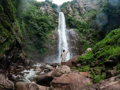
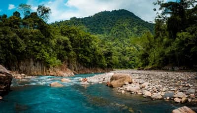
The name comes from the Quechua word Punku, meaning “door” or “gateway”, and Mainique, the name of the area. Its dimensions are impressive: barely 45 meters wide, with rock walls rising up to 1,200 meters above the river, along a 3-kilometer stretch where the water drops sharply and more than 30 waterfalls descend from the cliffs. It is located at 450 meters above sea level, between the districts of Echarati and Megantoni, in the province of La Convención, Cusco.
For the Matsiguenka Indigenous people and other communities of the Lower Urubamba, Pongo de Mainique is not only a geological phenomenon: it is the spiritual center of their world. According to the Matsiguenka worldview, the Pongo is the gateway to the spiritual world where the jungle gods live, and the place where the world was created. The souls of the deceased travel through the Pongo toward the afterlife.
The Incas, impressed by its powerful currents, considered it sacred and impenetrable. It is no coincidence that, only a few kilometers away, in equally dramatic landscapes, they built Machu Picchu and the mysterious Vilcabamba, the last refuge of the empire.
Today, the Pongo remains a living territory for the native communities of Timpía, Camisea and Megantoni, whose inhabitants are the guardians of this land.
Pongo de Mainique is part of the Megantoni National Sanctuary, a protected natural area created on August 18, 2004 by Supreme Decree No. 030-2004-AG. With 215,868 hectares, it protects one of the most biodiverse ecosystems on the planet, including 10 different life zones ranging from 416 to 3,960 meters above sea level.
In 2021, UNESCO recognized Megantoni National Sanctuary as a Core Zone of the Avireri-Vraem Biosphere Reserve, one of the world’s most important environmental recognitions.
The Sanctuary is home to extraordinary biodiversity. Among the 378 recorded bird species, the following stand out:
🦜 Military Macaw (Ara militaris) — an emblematic species of the Sanctuary and endangered
🐦 Andean Cock-of-the-rock (Rupicola peruvianus) — Peru’s national bird
✨ Golden-tailed Sapphire — a golden-tailed hummingbird endemic to the region
🦜 Several species of Amazonian parrots, macaws and toucans
Among the mammals found here are the Spectacled Bear (Tremarctos ornatus), the Giant River Otter (Lontra longicaudis), the Spider Monkey (Ateles belzebuth) and the Red Howler Monkey, among others.
The most accessible and recommended route to visit Pongo de Mainique starts from Quillabamba, the nearest city:
Quillabamba → Ivochote by land, approximately 5 hours: travel by private vehicle or with a local agency to the town of Ivochote, the main river port for accessing the Pongo.
Ivochote → Pongo de Mainique by river, approximately 2 hours: board a motorized canoe, locally known as a “bote ponguero”, and navigate downstream along the Urubamba River to the Pongo.
Important: It is recommended to hire an authorized local travel agency. Navigation through the Pongo requires certified guides and suitable boats. Traveling independently without previous experience in jungle river navigation is not recommended.
From Cusco, the full journey is: Cusco → Quillabamba, 5 hours by bus + Quillabamba → Ivochote, 5 hours + river navigation, approximately 2 hours. For this reason, tours to the Pongo usually require at least 2 days.
The dry season, from May to October, is the best time to visit the Pongo. During these months:
The flow of the Urubamba River is more stable and predictable.
The waters of the Yoyato River show their turquoise color in full splendor.
The roads and trails inside the sanctuary are passable.
River navigation conditions are safer.
During the rainy season, from December to March, strong currents and whirlpools make the Pongo one of the most dangerous river passages in Peru. Avoid visiting during these months.
Can you reach Pongo de Mainique without an agency?
Technically yes, but it is not recommended. Navigation through the Pongo requires knowledge of the river, certified boats and local guides who understand the currents. It is always safer and more comfortable to travel with an authorized agency.
Is there internet or mobile signal at the Pongo?
No. The Megantoni National Sanctuary area has no mobile coverage. Be ready to disconnect from the digital world — and enjoy it.
What is the Tinangaroni stone?
It is a rock formation of great spiritual importance for Matsiguenka culture, located along the river route. Your guide will explain its history and meaning during the tour.
Para que disfrutes al máximo tu experiencia, te recomendamos llevar lo siguiente:
Mayo a octubre (temporada seca). Evitar diciembre a marzo por lluvias y caudales peligrosos.
Siempre en canoa motorizada con guía certificado. No navegar el Pongo de forma independiente.
No hay cajeros ni señal móvil en el Santuario. Lleva efectivo para el viaje.
Repelente con DEET, protector solar SPF 50+, sombrero y ropa de manga larga para la selva.
Bolsa impermeable (drybag) para cámara y celular. El rocío de cataratas y el agua del río son inevitables.
No dejes basura, no toques la fauna silvestre y sigue las indicaciones del guía. Es un área protegida y un lugar sagrado.

Explore the landscapes that await you in this unique adventure.
Experiences and tours that include this destination.
Destination location and meeting point.